

A Subtle Return of La Niña
EO Science Earth Observatory A Subtle Return of La Niña Earth Earth Observatory Image of the Day EO Explorer
After a several-month hiatus, La Niña returned to the equatorial Pacific Ocean in September 2025 and has continued into December. However, this occurrence of El Niño’s cooler counterpart is relatively weak, and its influence on weather and climate over the next several months remains to be seen.
Part of the El Niño-Southern Oscillation (ENSO) cycle, La Niña develops when strengthened easterly trade winds intensify the upwelling of cold, deep water in the eastern tropical Pacific. This process cools large swaths of the eastern and central equatorial Pacific while simultaneously pushing warm surface waters westward toward Asia and Australia. In a report published on December 11, the NOAA Climate Prediction Center confirmed that below-average sea surface temperatures associated with La Niña conditions were present and likely to continue for another month or two.
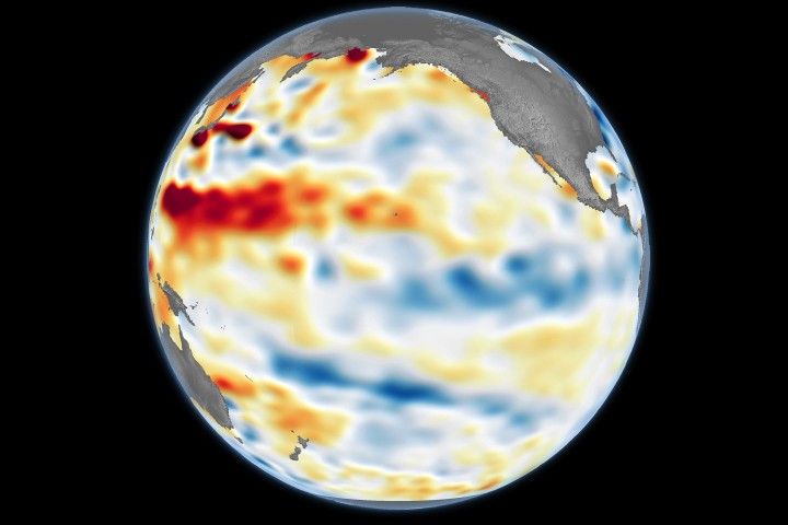
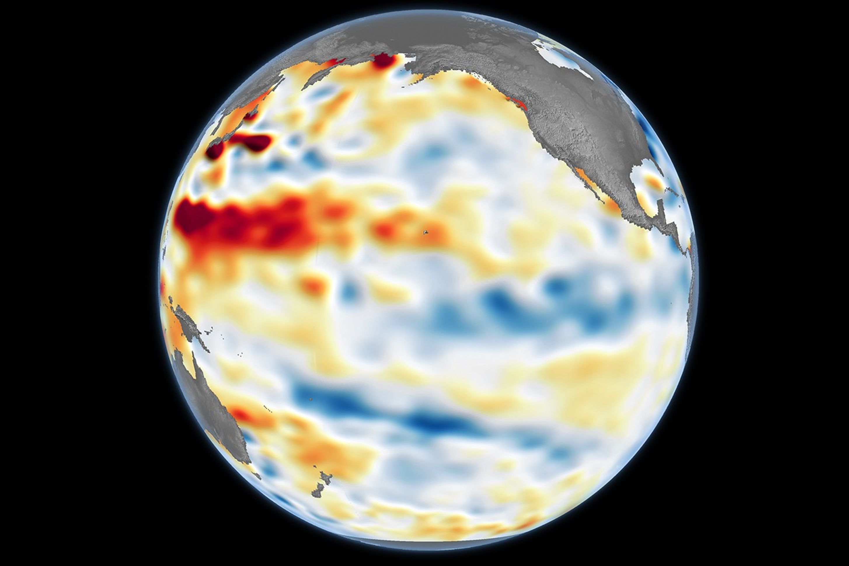
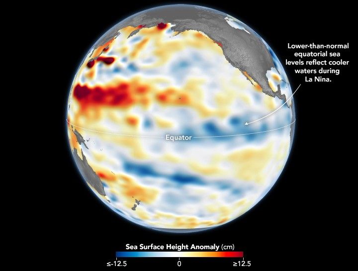
The shifting wind patterns and the movement of heat within the ocean have a direct impact on sea level. Because cooler water is denser and occupies less volume than warm water, sea levels in the central and eastern Pacific drop during La Niña events. The map above shows sea surface height observed on December 1, 2025. Shades of blue indicate below-normal sea levels, shades of red show above-normal levels, and white represents near-normal conditions.
Data for the map were acquired by the Sentinel-6 Michael Freilich satellite and processed by scientists at NASA’s Jet Propulsion Laboratory (JPL). Signals related to seasonal cycles and long-term trends have been removed to highlight sea level changes associated with ENSO and other short-term natural phenomena. The satellite’s twin successor, Sentinel-6B, launched in November 2025 and is expected to begin contributing to ENSO research and forecasts sometime in 2026.
This equatorial surface-water cooling alters the exchange of heat and moisture between the ocean and atmosphere, reshaping global atmospheric circulation patterns. La Niña’s coupling with the ocean and atmosphere can shift mid-latitude jet streams, intensifying rainfall in some regions while bringing drought to others.
Typically, La Niña years bring below-average rainfall to the American Southwest and above-average rainfall to the Northwest. But when the event is weak—whether El Niño or La Niña—the associated weather patterns can be “notoriously difficult to predict,” said Josh Willis, an oceanographer and Sentinel-6 Michael Freilich project scientist at JPL in Southern California.
“It still has the potential to tilt our winter toward the dry side in the American Southwest,” Willis said. “But it’s never a guarantee, especially with a mild event like this one.”
NASA Earth Observatory image by Lauren Dauphin, using modified Copernicus Sentinel data (2025) processed by the European Space Agency and further processed by Josh Willis and Kevin Marlis/NASA/JPL-Caltech. Story by Kathryn Hansen.
References & Resources
- NASA Earth Observatory (2025) El Niño. Accessed December 15, 2025.
- NASA Earth Observatory (2025, February 6) La Niña is Here. Accessed December 15, 2025.
- NASA’s Jet Propulsion Laboratory (2025) Ocean Surface Topography From Space. Accessed December 15, 2025.
- NOAA Climate Prediction Center (2025, December 11) El Niño/Southern Oscillation (ENSO) Diagnostic Discussion. Accessed December 15, 2025.
- World Meteorological Organization (2025, December 4) WMO Update predicts weak La Niña. Accessed December 15, 2025.
You may also be interested in:
Stay up-to-date with the latest content from NASA as we explore the universe and discover more about our home planet.

Sea ice around the southernmost continent hit one of its lowest seasonal highs since the start of the satellite record.

One of NASA’s newest Earth-observing sensors extends and improves the continuous measurement of light-harvesting pigments in ocean surface waters.

A multi-year drought has put extra strain on farmers and water managers in the Middle Eastern country.


